Capture geographical metadata and embed it into photos for accurate location verification. Our geotagging services help private enterprises and government agencies audit assets, verify on-ground presence, and ensure field data integrity.
Book a Strategy CallGeotagging
Accurate Geotagging Services for Audits and Field Verification
We provide reliable geotagging solutions tailored for location-based audits, field data validation, and asset tracking. Our team captures time-stamped, geotagged photos to verify physical presence across urban and remote locations. Whether for infrastructure audits, field surveys, or public service verification, our geotagging services support government programs and private initiatives with consistent, verifiable data.
Location-Stamped Evidence for Every Field Activity
Embed precise location data such as coordinates, latitude and longitude, timestamp, and full address into every visual report. Equip field teams to capture proof of activity with accuracy and integrity.
-

Precise Location Tagging
Every image is geotagged with latitude, longitude, and timestamp for location-verified records.
-

Tamper-Proof Evidence
Secure capture mechanisms to ensure data integrity and prevent manipulation.
-

Custom Audit Workflows
Adaptable to your existing field verification or monitoring processes.
-

Scalable Across Geographies
Efficiently supports large-scale audits in urban, semi-urban, and remote areas.
-

Use-Case Ready for Public & Private Sector
Trusted for both enterprise operations and government programs.
A Pan-India Audit and Monitoring Success Story
A government flagship scheme was promoted nationwide through OOH advertising across cities, towns, and remote rural areas.
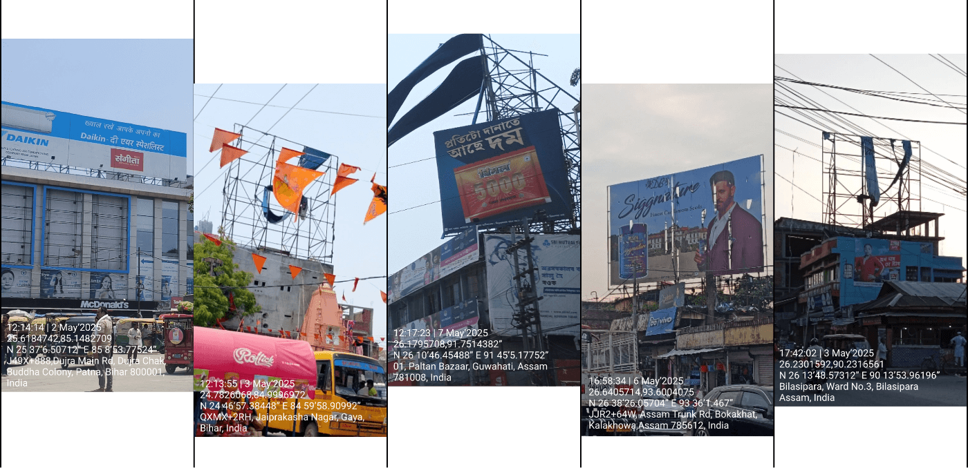
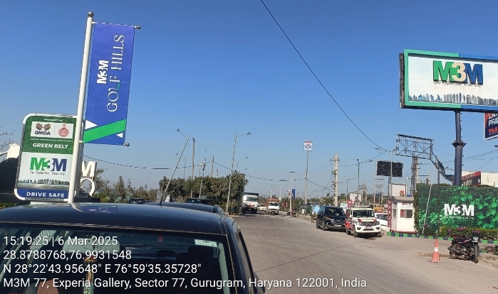
Using our on-ground audit application, field teams conducted extensive site inspections, capturing every visual report with geotagged metadata for time-stamped, location-verified proof of ad placements.
The audit enabled central authorities to identify discrepancies, ensure compliance at scale, and confirm message delivery to the intended audience—all backed by secure, tamper-proof geotagging.
Collect, manage & share geographical metadata
Geotagging: A Reliable Way to Validate Location-Based Field Activity

Inconsistent location data, missing metadata, and manual uploads make field audits unreliable. One of the biggest challenges is tampering—doctored images, spoofed coordinates, or outdated photos can compromise the integrity of the entire process. Without geotagged, tamper-proof evidence, it’s difficult to trust what’s reported from the ground. Our Geotagging services ensure every photo is time-stamped, geotagged, and securely traceable—bringing accuracy and accountability to field operations.
- Capture timestamped, geotagged visual reports from the ground
- Verify each photo’s origin using tamper-proof metadata
- Eliminate uncertainty in site-level reporting
- Maintain consistent data standards across locations
- Enable transparent audits with verifiable proof of location
Frequently Asked Questions
Learn more about our services, tools, and processes, and find quick answers to common questions.
Learn more about our Geotagging services—verify every on-ground activity with time-stamped, location-tagged data, explore how it works, and see our tools in action.
Request A DemoIf You Can’t Join Them, Beat Them!
The Meridian.API Newsletter
A newsletter about geospatial analytics, location intelligence, AI, data science, and data visualization. A newsletter about building world class products, and use of science, mathematics, and logical reasoning.
And as Aristotle might say, ‘A newsletter about keeping pleasure in the job that puts perfection in the work.’

Contact
Request your personalized strategy call and demo—just complete the form and we’ll be in touch shortly.

- Monitoring & Audit
- Product Development
- Other